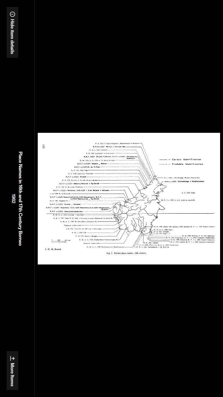
Place Names in 16th and 17th Borneo by Jan O.R. Beck in Imago Mundi vol. 16, 1962
The coast of Borneo served as anchorage for ships going to and from China. However, the area had its resources.
Suvarnahumi (Land of Gold) an Indian term, may have included Borneo and other parts of the western archipelago.
Karpuradvipa, Camphor Island, another Indian name and a name Borneo shared with Sumatra meant chewing camphor. The camphor incense type was also harvested from this area.
Poli, an ancient Chinese trade centre located at Santubong, was formed in the 6th century and lasted until about 1300 AD. The area around Brunei Bay seems to be a much later trade centre.
Puradvipa, Diamond Island, indicated a Javanese name.
There were two Sarawakson on the east coast of Borneo according to a Javanese map.
Many of the main towns of Borneo, Jesselton, Pontianak, Kuching and others, were relatively new administrative or trade centres.
The following have been mentioned by the Madaphit: Kapuas, Katingan, Sampit, Kuta Lingga, Kuta Waringin, Sambas, Wawai (Lawai?), Kadangan, Landa, Samedang, Tirem, Sedu, Burune, Kalaka, Saludung, Solot, Pasir, Baritu, Sawaku, Tabalung, Tunjung, Kute, Malano and the capital, Tanjungpuri.
Solot refers to the Sulu Islands.
Tirem probably refers to Peniraman on the northern Kapuas River.
Sedu could be Sadong in Sarawak
Saludang refers to Serudong river district behind Sebatik Isand on the East Coast.
Chinabalu is located at Kota Kinabalu. Was there a Chinese town where Kota Kinabalu is today?
Carena, There must have been a town called Carena in the 1500s where Kuching is today.
Tamarato Tanjung Datu
Carena
There could have been a town called Carena in the 1500s where Kuching is today. Carena in a dialect of Spain means ridge.
Lave or Lawai
subject to the King of Madjapahit; an area where the power of Brunei and Madjapahit overlapped; along the lower Kapuas river; very near the equator; Lauwe is land along the Kapuas; centre of the diamond district;
Hermata
European maps show Hermata just north of the equator on the west coast of Borneo. Sometimes is shown as a city and other times as an area. Shown as a kingdom from the Kapuas River to the Sambas River and then to the Sarawak River. Premata in old Malay means precious stones.
Santubong
Santubong is not mentioned on any of the maps. The reason is Brunei troops destroyed and flattened the city around ~1500 which was too early for the European people making the maps. Tom
Tanjungpura
The search for the entity of Tanjungpura on Borneo Island ranges from Brunei to Barito. Chinese records of the Sung Dynasty (960-1279) speak of Tan-jung-wu-lo or Tung-chung-ku-la. Javanese historians in the 1300s used the term Tanjungpuraor Tangungnegara for the southeast coastline of Borneo. In 1620, Tanjong Rodi appears on one map and Tanjungpura appears on a larger map by the same cartographer.
The Dieppe maps, maps produced in Dieppe France from 1540-1560, wrote the name Tanjungpura across the south of Borneo and considered it a region and not a city. It is thought they match the Javanese maps of the 1300’s.
Portuguese sources mention the diamonds of Tangungpura. A sailor in the early 1500s reports calling at the port of Tanjungpura. He mentions that near the city are diamonds. Tan Jao Pute a city, is designated as 3’11 S. Pires tells of an island called Tanjungpura rich in gold and diamonds.
Being on the coast and visited by ships, described as an island and being near the diamond and gold trade centres, the author of this paper concludes that Sukadana is the new name for the old diamond and gold trading centre of Tanjungpura.
BorneoHistory.net
