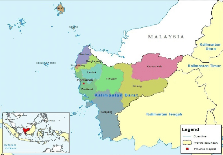
Ketapang
The Dayak kingdom was called “the Dayak Kingdom of the Headwaters.” It was located in the interior of Ketapang. The kingdom was a regional federation of the Dayak group, and the kingdom once controlled a large area that encompassed north of the Kapuas River. The kingdom lasted until the Dutch took over in the 1850s.
Our location centres around Sengkuang. The area around Sengkuang includes the old inland paths that connected the south (Matan and Ketapang) the west (Sukadana and Simpang) and the north (Tayan, Meliau, Sanggau and Sekadu)
In July 1823, a Mr C.L. Hartmann journeyed to the Ketapang area. The area’s two kingdoms, Simpang which lay upriver on the Simpang River and Matan (located at Kartapura) were descended from the Kingdom of Sukadana. Sukadana had been founded much earlier by a Javanese nobleman, most likely connected to Majapahit.
Hartmann had observed the number of Dayak belonging to Matan amounted to 30,000 men. However, only 10,000 of these numbers paid tribute to the Dayak sultan. He also listed the names of the Dayak settlements belonging to Simpan. This list was confirmed in 1843, 1859,1862 and 1893.
Following the establishment of Raja Akil of Sukadana in 1829, the influence of Matan and Simpang weakened further. In 1840, two American missionaries travelled up the Kapuas River and remarked on the instability and decrease in population in the Sukadana area. There was also warfare between the families of Matan, Kotawaringan, Sambas and Banjermasin.
By 1896, the account by J.P.J. Veth also focuses on Sukadana, Simpang and Matan. The territory of Matan, by then based at Tanjung Pura and Ketapang, includes Bea (Behak). A list of Dayak Kampongs includes Mriangin on the Kerian River. Veth also discusses the Malay Kampongs (orang Bukit) of Simpang and Matan. These two Kampongs could be the origins of the sites of early Tanjungpura.
Here the authors digress. They consider the staff (Bosi Koling Tungkat Rakyat) used by Dayaks as symbols of authority could be derived from the Spanish. The other point is the Java origins of the names of the headmen seen in the 1820s. These names highlight the special relationship between the Dayaks and the earlier Malay kingdoms. For example, the Ulu Are title of tamongong probably stems from an even older Javanese-Hindu organization.
Yet, stories of the Ulu Are people provide intriguing historical clues. When D.J. van Dungen Gronovius went up the Kapaus River in 1822, he learned about the trade-oriented people further upriver. These included the Silat, Kapouas, (Selimbau) Ambouw, (Embow or Jongkong) and Malo. The Malo consisted of 12 settlements, 1,020 households, and 5100 able bodies men on the Embolah River. These numbers are thought to be grossly exaggerated. Most names and communities exist today (1991) indicating a long-term settlement.
What happened to the Malo kingdom? The Malo was thought to be a collection of villages with no “headman or king” but rather a group of hereditary elite who dealt in trade and intermarried with the elites of other tribes.
Before European involvement, Malay identity served to connect people to a regionally prestigious network. Said of the Selimbau, the only difference between the Malay and the Dayak was headhunting.
By the 1850s, when the Dutch began to administer the interior of Borneo, the Malay rulers were Muslim and Islam began to take hold of the upper Kapuas River. Some nominally Muslim people continued to drink Arak (rice wine) and lived in longhouses. However, the Ulu Are people remained Dayak. Had they entered Islam, their nationality would have changed from Dayak to Malay per custom.
Local Malay rulers were seen by the colonial powers as greedy, profiteering extortionists who suppressed the Dayak and practised debt slavery. This helped the Dutch colonists to use the excuse to “lift the yoke of oppression” and to continue their intervention policies. On the other hand, the Dutch made treaties with the Malay rulers which allowed them to continue their practices.
In 1881, the Dutch awarded the Empanang drainage area to the Selimbau people. Many Kantu’ also lived in the area and could not abide by this. They abandoned their homeland and, coupled with Iban raiding, relocated elsewhere.
In 1910, a tax revolt among the Dayak against the Malay rulers in the Ketunggau River caused the Dutch to send in troops. By this time, Dayaks were disempowered, and the Malays became prominent in education and colonial employment. The procedure of the Dutch favouring the Malays over the Dayak continued in many other river valleys.
As to its current status, John Bomba (2001) stated the kingdom exists as a spiritual force only. The “king” Rajah Hulu Aiq (Dayak krio language) has no powers whatsoever. However, he reigns, in the Dayak’s mind, as the highest spiritual leader of the Dayaks. The kingdom is called “the nine villages and ten customary chiefs (desa sembilan demung sepuluh)”. He is regarded as the guarantee of Dayak’s good faith, especially regarding farming. The respect paid by the Malay Sultans to this spiritual world arose from the spiritual power, despite the oppressive power imposed on the Dayaks by the Malays.
Dayak Kings, Malay Sultans, Oral Histories and Colonial Archives: A Comment on Dujuweng and Sellato by Reed L. Wadley and F. Andrew Smith in Borneo Research Bulletin vol. 32 2001
The Dayak Kingdom in West Kalimatan: Spiritual of Earthly? By F. Andrew Smith and Reed L. Wadley in the Borneo Research Bulletin, vol. 33, 2002
Condensed with permission from the Borneo Research Bureau by Tom McLaughlin